
Reviewed · PUERTO RICO
Puerto Rico Unlocked 500+ Hidden Gems and Spots
Puerto Rico Unlocked turns the whole island into a flexible road-trip plan, with 500+ marked places covering everything from quiet beaches and river pools to churches, plazas, food stops, caves, and odd roadside sights. You tap a pin, open Google Maps, and decide what sounds good that day.
I like the freedom and the time saved. You can build a route around your own interests instead of following a bus schedule, and the map gives you far more than the usual San Juan, El Yunque, and beach circuit. The price is also strong at $29.99 per group of up to 15 people.
The catch is important: this is not a guided tour. You provide the car, fuel, tolls, parking, meals, and any equipment. Some places require a fair level of fitness, and river stops call for careful weather checks.
In This Review
- Key points to know before you buy
- What you are really buying for $29.99
- How the digital map works on the road
- Day 1: 87 rivers around Río Grande
- Day 2: 105 beaches from Aguadilla onward
- Day 3: 21 viewpoints in the hills near Lares
- Day 4: Forts, churches, and old buildings around Aguada
- Day 5: Nine food stops around Luquillo
- Day 6: More than 50 unusual places near Ponce
- Day 7: More than 50 town plazas around Toa Alta
- Day 8: 87 or more churches and sacred places near Carolina
- Building a sensible eight-day route
- Who will get the most from this map
- Practical limits that affect the value
- Should you buy Puerto Rico Unlocked?
- FAQ
- Is Puerto Rico Unlocked a guided tour?
- How many locations are included?
- How do I navigate to a location?
- How long is the experience?
- Do I need a rental car?
- Are entrance fees included?
- Is the map suitable for river visits?
Key points to know before you buy
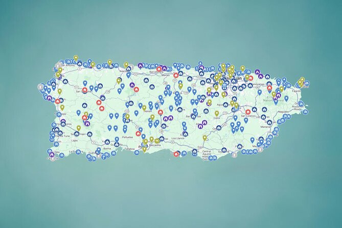
- 500+ locations across Puerto Rico: Find beaches, rivers, waterfalls, caves, viewpoints, historic sites, churches, plazas, food stops, and unusual attractions in one phone-friendly map.
- Direct Google Maps navigation: Tap a location and open it in Google Maps instead of copying addresses from scattered websites.
- Eight suggested days: Each day highlights one broad category, with roughly four hours suggested for that section.
- Full freedom to choose: There is no guide, fixed route, or required schedule. You can use the map for a long road trip or select just a few nearby stops.
- Lifetime digital access: You receive ongoing access, with new locations and updates added regularly.
- Plan for outdoor risks: Rivers can rise quickly after rain. The provider advises visiting river areas only in fully sunny conditions with no rain forecast.
What you are really buying for $29.99
You are not buying transportation or admission to an attraction. You are buying a ready-made research tool that puts hundreds of possible stops in one place.
That distinction matters. Puerto Rico is large enough that planning by random searches can eat up hours. You may find an old blog post, a short social-media video, and a map pin with little useful detail. This product gathers the options into categories and places them behind clickable pins.
At $29.99 per group, the math works especially well for a family or group of friends. Fifteen people could theoretically share one purchase, although everyone will need a practical way to view and use the map. Even for two people, the price can be reasonable if it saves you a morning of sorting through repetitive or outdated information.
The value depends on how you travel. If you want a set half-day tour with a driver and guide, this is the wrong product. If you already plan to rent a car and enjoy making decisions as you go, it can pay for itself in saved planning time.
You should also keep a small budget for parking, tolls, fuel, food, and possible entrance fees. Most places are free, but not all of them are.
Other Puerto Rico days people book alongside this one:
- San Juan Guided Snorkel With Turtles Tour and Videos
★ 5.0 · 12,947 reviews - Top Rated El Yunque Rainforest & Waterslide – SmallGroup Tour
★ 5.0 · 12,789 reviews - Half-Day Yunque Rainforest Waterslide & rope swing Guided Tour
★ 5.0 · 6,534 reviews
How the digital map works on the road
The basic system is simple. Open the map on your phone, choose a pin, read the available photos, tips, and links, then send the location to Google Maps for navigation.
That makes the map useful in two different ways. Before your trip, you can look across the island and sketch out a route. During the trip, you can check nearby options when the weather changes or your original plan loses its appeal.
I especially like this format for people who dislike rigid itineraries. You might plan a beach morning, notice a viewpoint or plaza close to your route, and add it without rebuilding your entire day.
There are practical limits. Phone service and battery power matter, so download or save what you need before heading into remote areas. The supplied information confirms mobile access, but it does not promise offline navigation or signal in every part of Puerto Rico.
The map is also only as good as your judgment about driving time, road conditions, opening hours, and weather. Treat each pin as a useful lead and starting point, not as a guarantee that every place will be open or easy to reach.
Day 1: 87 rivers around Río Grande
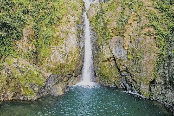
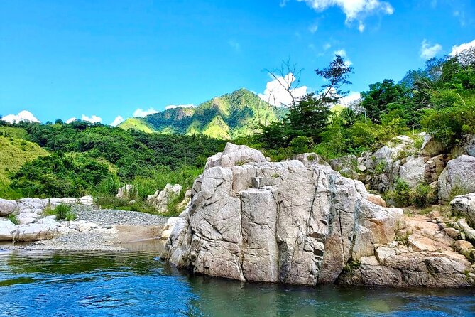
The first suggested section points you toward 87 rivers, waterfalls, and natural pools, with Río Grande as the day’s anchor. This is the map at its most adventurous, offering access to watery places beyond the standard visitor circuit.
Some stops may be quiet river bends, while others may involve a walk, uneven ground, or swimming. The supplied details do not give a separate difficulty rating for each location, so you need to judge your own fitness and comfort before setting out.
The weather warning here is not a minor footnote. Rain can send water levels and currents up quickly, even if the sky above your chosen swimming spot looks calm. Check the forecast for the whole area and avoid river visits on cloudy days or when rain is possible.
You also need to bring or rent your own equipment. Helmets and life jackets, when a particular outing calls for them, are not included. The map can point you toward an outdoor setting, but it does not replace local safety advice.
Day 2: 105 beaches from Aguadilla onward
Aguadilla introduces the largest collection in the schedule: 105 beaches. That number gives you room to shape the day around your mood, from a quiet shore to a family-friendly place with palms and roadside food.
A beach list is most useful when you do not want to spend your entire holiday at one famous strip. You can compare locations, choose a shore that fits your route, and keep another option ready if weather or parking changes your plan.
The tradeoff is distance. One day cannot sensibly cover 105 beaches, and the suggested four hours is best understood as a planning block, not a promise that you will see every location. Pick two or three places in one area rather than zigzagging across the island.
The map may help you find a food stall or a less-used shoreline, but it does not include meals or drinks. Carry the basics you need for the day and confirm any local rules before swimming or parking.
Same island, a completely different day out:
- El Yunque Rainforest Waterslides and Luquillo Beach w/ Transport
★ 4.5 · 5,098 reviews - Night Kayak – Condado City Lights Tour
★ 4.5 · 4,807 reviews - Luquillo Beach Horse Ride from Carabalí Rainforest Adventure Park
★ 5.0 · 4,762 reviews - Authentic Flavors of San Juan Food Tour
★ 5.0 · 4,741 reviews
Day 3: 21 viewpoints in the hills near Lares
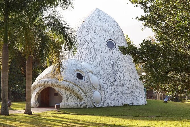
The Lares section turns inland, with 21 viewpoints offering mountain and Caribbean views. This is a good counterpoint to the coast, especially if you want photographs, cooler air, and a sense of Puerto Rico’s interior.
Viewpoints are easy to underestimate. A pin may represent a formal lookout, a roadside stopping place, or a simple point with a clear view. The information does not spell out the access conditions for each one, so use common sense about where you park and how far you walk from the car.
Four hours gives you time to choose several points in one region, but not to race from one end of the island to the other. I would use the map to build a compact loop and leave room for unplanned stops.
This section suits people who want scenery without committing to a long outdoor activity. It is also a useful backup when rain makes river plans unsafe, though you should still check local weather before driving into the hills.
Day 4: Forts, churches, and old buildings around Aguada
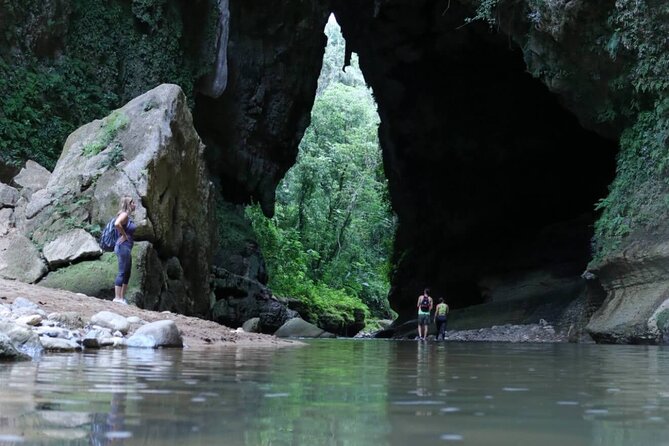
The Aguada day focuses on historic places, including forts, churches, colonial buildings, and secret tunnels. This category gives the map more depth than a simple list of swimming spots.
You can use it to connect different towns and understand how faith, defense, and daily life shaped the island. A church or plaza may take only a short visit, while a fort or historic building can deserve more time. The map includes links and notes, but you should check current opening details when a site has an entrance fee or limited hours.
This is one of the better sections for families and mixed-age groups because it does not require every person to swim, hike, or climb. It also gives you a change of pace after outdoor days.
Do not assume every historic location operates like a formal museum. Some may be viewed from outside or depend on local access. The supplied information confirms that admission fees are not included, and some sites or parking areas may charge.
Day 5: Nine food stops around Luquillo
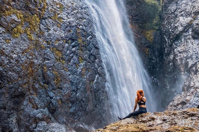
Luquillo is the food-focused day, with nine stops featuring Puerto Rican favorites such as alcapurrias, mofongo, lechón, and tropical drinks.
This part is valuable because food stops can turn a drive into a local experience rather than a string of photo stops. You can plan a meal, share several dishes with friends, and use the map to add flavor to a day that might otherwise be built only around scenery.
Nine places is a manageable number, but you should not try to eat at all of them in one sitting. Use the list as a menu of possibilities and make choices based on your route, appetite, and opening hours.
Nothing edible is included in the purchase. Bring payment for meals and drinks, and remember that small roadside businesses may have changing hours. The map can save you the search, but it cannot guarantee that every food stop is serving when you arrive.
Day 6: More than 50 unusual places near Ponce
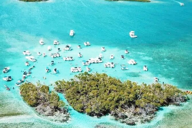
The Ponce section gathers more than 50 places that do not fit neatly into the other categories. The examples include tunnels, unusual rock formations, waterfalls, giant sculptures, stairways, and unexpected corners.
This may be the most playful part of the map. It is for the person who prefers a strange local sight over another standard attraction. You may find a place that gives your itinerary a story, even if it takes only a short visit.
At the same time, the broad category makes planning important. A tunnel, waterfall, or rock formation may require very different preparation from a sculpture or staircase. The supplied details do not provide individual safety notes, so read each pin carefully and avoid entering unsafe areas.
Ponce is also far from some other regions listed in the eight-day plan. Build this as a regional day rather than trying to combine it casually with distant stops. Your rental car is central to the experience, and fuel, tolls, and parking remain your responsibility.
Day 7: More than 50 town plazas around Toa Alta
The plaza collection covers more than 50 town squares, with Toa Alta as the day’s starting point. These are places for slowing down: trees, benches, churches, music, children, pigeons, and ordinary local life.
I like this category because it asks you to look beyond scenic stops. A plaza can show you how a town works and give you a break from driving. It is also a sensible choice for anyone who wants cultural context without a demanding hike or expensive attraction.
Again, you cannot reasonably visit all 50 in four hours. Choose a few that fit one route, then allow time to sit, walk, and look around. The map’s photos and links should help you decide which ones interest you most.
Town squares are public spaces, but individual events and businesses may change. Keep your plans flexible, especially if you are hoping to hear music or find a particular local activity.
Day 8: 87 or more churches and sacred places near Carolina
The final section includes more than 87 sacred sites, from major cathedrals to modest chapels. Carolina is the day’s listed area, but the collection reaches across Puerto Rico.
You do not need to be religious to appreciate this category. Churches and chapels can offer architecture, art, local stories, and a quiet pause during a busy road trip. This is another good option for a group with different interests because visits can be short and do not require special equipment.
Respect matters here. Dress and behavior should suit an active place of worship, and access may depend on services or local schedules. The supplied information does not promise interior access at every site, so be prepared to view some places from outside.
Like the plaza list, this is a menu, not a checklist. Pick a few sites near one another and avoid spending the whole day crossing the island for isolated pins.
Building a sensible eight-day route
The eight-day outline is a useful way to organize the map, but it is not a fixed guided itinerary. Each day lists one region or category and about four hours, leaving the rest of the day for driving, meals, rest, and extra stops.
You should not read the plan as eight compact excursions from one meeting point. The locations spread across Puerto Rico, and the map is designed for self-driving. A rental car is essential to the experience.
Before leaving, group pins by region. Choose a main activity, a food option, and one backup. That approach keeps you from wasting time on long detours and gives you a plan when rain closes off an outdoor stop.
The stated meeting point is Plaza Colón at C. de la Fortaleza in San Juan. Since this is a digital, self-guided product with no transportation or guide, that point is best treated as the listed start and end reference rather than a place where a guide will meet you.
Who will get the most from this map
I would recommend it most strongly to independent visitors who already plan to rent a car and want more choices than a standard guidebook offers.
It suits:
- Friends splitting the $29.99 group price
- Families who need flexible stops
- Solo visitors comfortable navigating by phone
- Repeat visitors who have already seen the major sights
- People staying long enough to explore more than one region
- Anyone who enjoys choosing a route each morning
It is less suitable if you want a guide, private transportation, scheduled pick-up, or a tightly managed day. It is also a poor fit if you dislike driving or prefer to see only a few central attractions in San Juan.
The product information gives a maximum of 30 participants, but this is not a conventional group outing. You will not be joining a scheduled coach or walking group.
Practical limits that affect the value
The map offers lifetime access and regular additions, which improves its long-term value. You can use it during one holiday, then return to it for another visit or share the planning benefit with your group.
Still, lifetime access does not remove the need for current checks. Roads, parking rules, opening hours, weather, and local conditions can change. Confirm details before setting out, particularly for rivers, churches, historic sites, and places that may charge admission.
Physical fitness also matters. The overall product includes easy cultural stops and more demanding outdoor places, so do not assume every pin is suitable for every member of your group.
The non-refundable policy is another reason to buy carefully. Once purchased, the amount cannot be refunded or changed. Make sure you want a self-guided driving tool before paying.
Should you buy Puerto Rico Unlocked?
Buy it if you want to take control of a Puerto Rico road trip and value saved planning time more than personal guiding. At $29.99 per group, it is a sensible purchase for people who will use several categories, especially beaches, rivers, viewpoints, food, and historic places.
Skip it if you need transportation, equipment, a guide, or guaranteed access to specific attractions. The map gives you choices, not a chauffeur or a safety service.
For the right person, its best feature is not the raw number of pins. It is the ability to replace scattered research with one working list, then shape each day around your own interests. Pack patience, check the weather, choose nearby stops, and let the map help you find a more personal side of the island.
FAQ
Is Puerto Rico Unlocked a guided tour?
No. It is a self-guided digital Google Map. Transportation, guide service, and equipment rental are not included.
How many locations are included?
The map includes more than 500 locations across Puerto Rico. Categories include rivers, beaches, viewpoints, historic sites, food stops, unusual places, plazas, and sacred sites.
How do I navigate to a location?
Use your phone to open the map, tap a pin, and open the location directly in Google Maps for GPS navigation.
How long is the experience?
The suggested program lasts approximately eight days. Each listed day includes about four hours for its featured category, but you choose your own schedule and stops.
Do I need a rental car?
Yes. Transportation is not provided, and the experience is designed for self-driving. You are also responsible for fuel, tolls, and parking.
Are entrance fees included?
No. Most listed places are free, but some sites and parking areas may charge an admission or fee.
Is the map suitable for river visits?
It can help you locate rivers, waterfalls, and natural pools, but you must check the weather first. Avoid river visits when rain is forecast or conditions are cloudy, since water levels and currents can rise quickly.
Just added around Puerto Rico
- CLEAR BOTTOM KAYAKS Tour in Bioluminescent, Mosquito Bay★ 4.0 · 30 reviews
- Private Windsurf Experience in Puerto Rico★ 5.0 · 7 reviews
- Private Tour of the White Canyon Ancestral Route in Utuado★ 5.0 · 7 reviews
- eFoil Lesson Old San Juan★ 5.0 · 5 reviews
- “Unique Tour” Loiza, Cultue, Art & Bomba Dance Class on The Beach★ 5.0 · 22 reviews
- Window Cave and Indian Cave private tour with an archaeologist as guide★ 4.5 · 9 reviews
- Private Wellness Tour of Puerto Rico Waterfalls and Hot Springs★ 5.0 · 5 reviews
- Authentic San Juan Guided Walking Food Tour with Pina Colada★ 5.0 · 3 reviews